About the Project
In this room, we will introduce you to the project and its schedule.
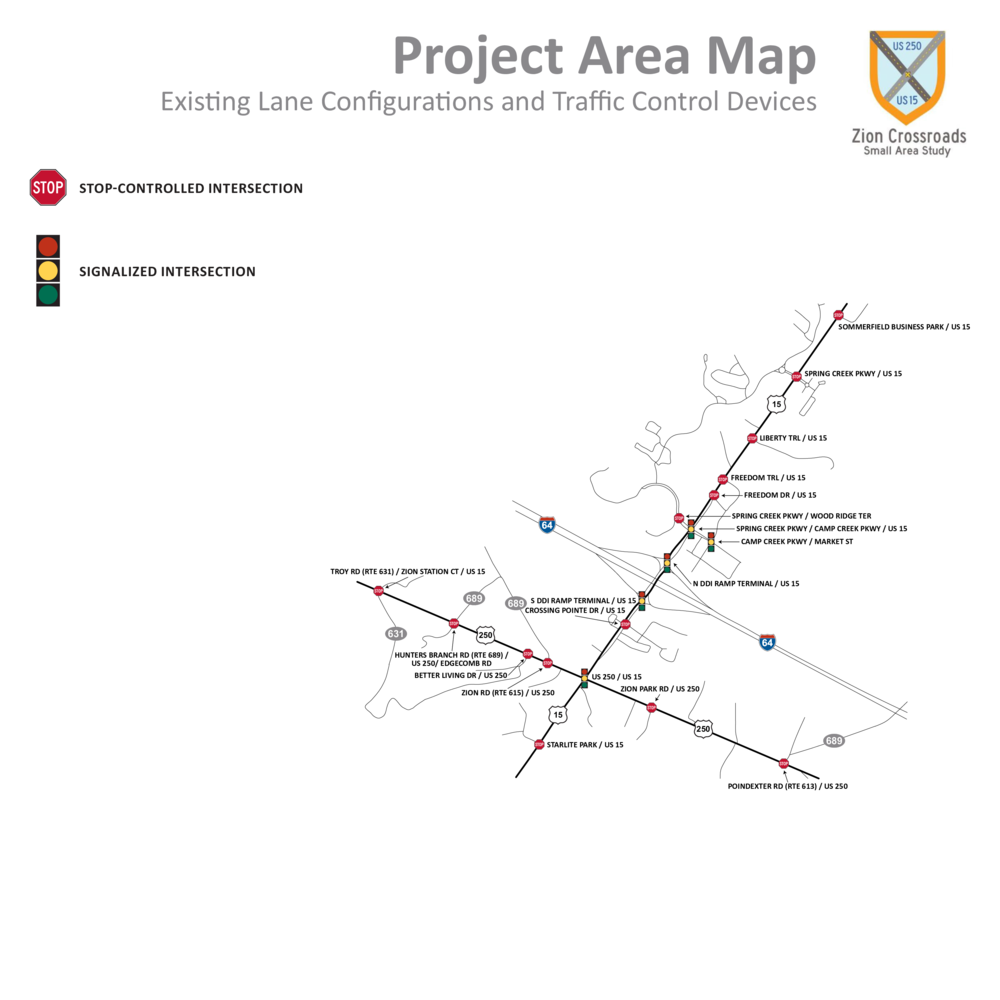
This study will evaluate US 15 and US 250 in Louisa and Fluvanna Counties. It will review the existing and future operational performance and safety of these roadways in this area. As a Corridor of Statewide Significance (CoSS) and part of the National Highway System (NHS), this corridor plays an important role in Virginia. The intersections of interest in this study are:
- US 15/Sommerfield Business Park
- US 15/Spring Creek Parkway
- US 15/Liberty Trail
- US 15/Freedom Trail
- US 15/Freedom Drive
- US 15/Spring Creek Parkway/Camp Creek Parkway
- Spring Creek Parkway/Wood Ridge Terrace
- Camp Creek Parkway/Market Street
- US 15/I-64 North DDI Ramp Terminal
- US 15/I-64 South DDI Ramp Terminal
- US 15/Crossing Pointe Drive
- US 15/US 250
- US 15/Starlite Park
- US 250/Troy Road (Route 631)/Zion Station Court
- US 250/Hunters Branch Road (Route 689)/Edgecomb Road
- US 250/Better Living Drive
- US 250/Zion Road (Route 615)
- US 250/Zion Park Road
- US 250/Poindexter Road (Route 613)
As a result of this study and your valuable input, all study intersections will be evaluated for potential improvements. After an initial screening of potential alternatives, improvements will be evaluated further for each intersection through development of conceptual designs and more detailed operational analysis. A second public meeting will be scheduled to collect feedback on these proposed designs!
